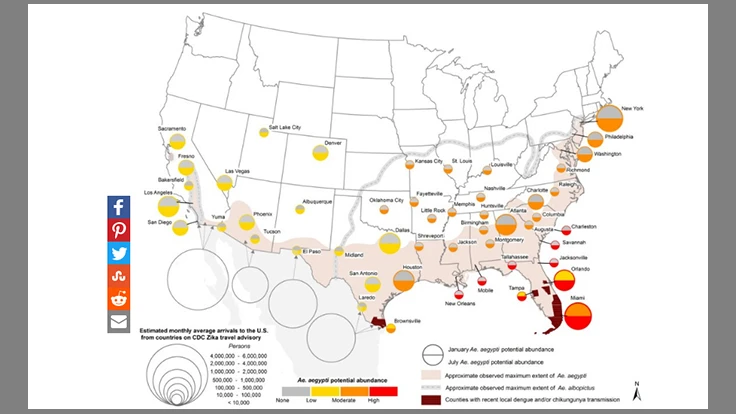
NASA scientists recently released maps detailing the potential spread of the Zika virus throughout the U.S. Many southern states and other major cities could be at risk.
Reported by CNN, the maps were released within a recently published study in the journal PLOS Currents, which examined 50 different cities within known range of the Aedes aegypti mosquito. The female of this species is known to carry Zika, as well as yellow and dengue fevers.
The scientists took several factors into consideration to attempt to predict the spread of the mosquitos, including rainfall, temperature, poverty levels, and amount of travel to Zika-infected areas.
Sources: NASA and CNN
Latest from Pest Control Technology
- Earn CEUs from Your State at Next Week’s Mosquito Control Virtual Conference
- Jody Green Talks Ticks at Purdue Conference
- Truly Nolen Pest Control Promotes Freize, Hackett
- Preserving Culture, Providing Opportunities Key in Hoffman’s Decision
- Winter Weather Could Decide How Bad Mosquito Season Gets
- Trent Frazer Discusses How Mosquitoes Survive Winter
- Barnes Exterminating Acquires Tennessee Pest Solutions
- Pest Index Up 9% YOY in January